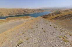
Kurgantepa (Urdatepe)
Kurgantepa is located in the Zaamin district center, on the left bank of the Zaamin river. The monument has drawn the attention of specialists repeatedly. Now It had almost completely lost its microrelief. Its citadel constructed under memorial, and adjacent territory is occupied with squares and residential buildings. According to scientists, in 1973 its dimensions were 100x95m, height - 14 m
Excavation 1 (4x6 m), oriented to the cardinal, was laid in a public garden, 15 meters south-west of the territory adjacent to the citadel. The entire surface of the little park is overgrown with grass, and there are ethnographic pottery and fragments of brick everywhere. There were fixed two main layers, the ethnographic (I-III stage) and developed the Middle Ages during excavation. The upper layer was different from not only the lower nature discoveries, but also the colour (black, gray), it is quite loose. While, the lower layer has a light colour of loess.
In the southern part of the excavation cleared large, burned hot spot and some ash tray in tier I. Besides a large number of glazed and unglazed pottery came across the burnt bricks. One of them remained completely (26x26x5 cm). There were also porcelain, shapeless pieces of iron, animal bones and a rather large stones. There is the ground in the northern part of the excavation, sometimes dense, traced the remains of masonry and raw pakhsa. In tier III, there were found pieces of ceramic slag defective crockery, glass. The whole area of the excavation is with intensive traces of habitation.
There is a very solid layer of small pebbles in the middle tier III. It is possible that this was the bottom of a reservoir or canal bed. It is also possible that this is a pebble-paved area or track. This gravel separates the upper from the lower layer. There is a Karakhanid times material under that layer.
Source: http://zaamin.uz/?q=en/kurgantepa-urdatepe


